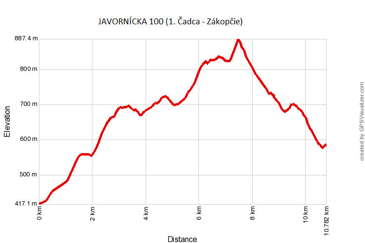
1. Čadca → Zákopčie, U Holých
- distance → 10,8 km
- ascent +590 m
- descent -422 m
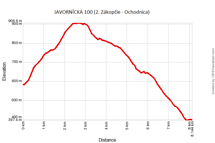
2.Zákopčie, U Holých → Ochodnica
- distance → 8,2 km
- ascent +353 m
- descent -539 m
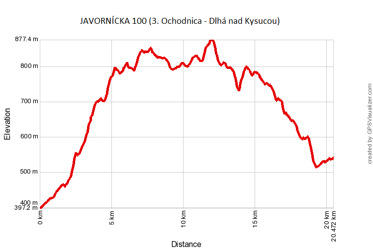
3. Ochodnica → Dlhá nad Kysucou, Kamenišťák
- distance → 20,6 km
- ascent +821 m
- descent -679 m
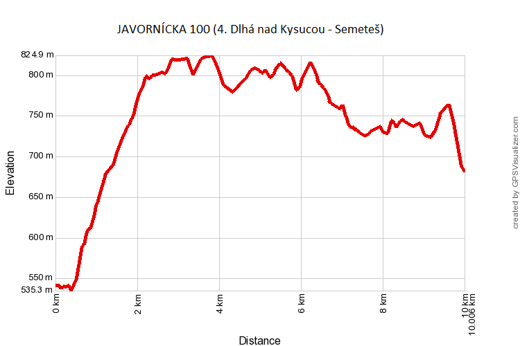
4. Dlhá nad Kysucou, Kamenišťák → Semeteš, U Cipára
- distance → 10 km
- ascent +517 m
- descent -376 m
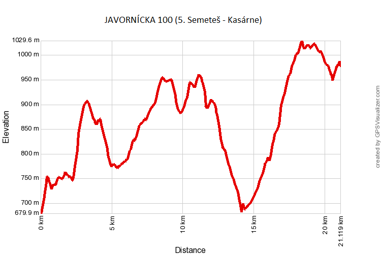
5. Semeteš, U Cipára → Kasárne, hotel Fran
- distance → 21,1 km
- ascent +1044 m
- descent -747 m
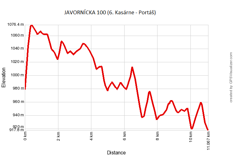
6. Kasárne, hotel Fran → Horský hotel Portáš
- distance → 11,1 km
- ascent +346 m
- descent -407 m
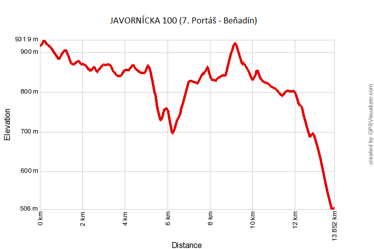
7. Horský hotel Portáš → Beňadin
- distance → 13,8 km
- ascent +504 m
- descent -913 m
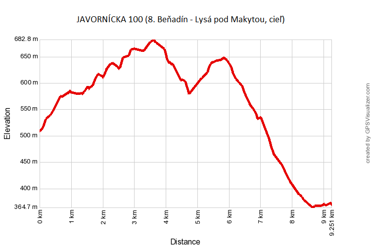
8. Beňadin → Lysá pod Makytou, finish in the elementary school building
- distance → 9,2 km
- ascent +305 m
- descent -443 m